Resilience Design (RD) is an innovative approach that blends permaculture, agroecology, passive water harvesting, and agroforestry to regenerate ecosystems and build thriving, climate-resilient communities. Jointly with national and international research and humanitarian aid organizations, we are using RD not only as a tool for ecological restoration and food security but also as a platform to demonstrate measurable, science-based impacts on land and people.
A Circular, Evidence-Based Design ApproachA Circular, Evidence-Based Design Approach
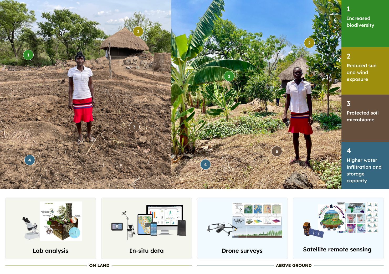
RD follows a four-phase design process—assessment, analysis, design, and implementation—guided by scientific data and community input. This cyclical process helps align human activity with the natural ecosystem, ensuring that design interventions improve environmental health and human well-being over time. Scientific data supports the RD process throughout all four phases and offers new ways to guide site selection, design, and impact analysis. Different technologies help to collect data across all scales ranging from households, farms, communities, to entire watersheds.
Science-Driven Planning and MonitoringScience-Driven Planning and Monitoring
To assess and guide RD interventions, we are spearheading science data analysis efforts that help scale RD throughout humanitarian aid programming. Environmental conditions are evaluated using a blend of:
-
Satellite remote sensing
-
Drone and aerial imagery
-
In situ data on environmental conditions
-
Socioeconomic and climate datasets
-
On-the-ground soil and vegetation surveys
These tools provide a comprehensive understanding of the landscape before, during, and after intervention.
In the RD assessment period, remote sensing helps, for example, to evaluate the level of degradation in an area, which can guide targeted program development. During the design phase, high-resolution Digital Elevation Models derived from satellites, drones, or geodetic surveys provide crucial knowledge about current water flow and information on where RD design elements like bioswales or contour dams are strategically placed. After implementation, we can track changes in plant and soil health, water infiltration and retention, and increase in biodiversity and ecosystem function.
Lok Neno - Developing the scientific basis for Resilience DesignLok Neno - Developing the scientific basis for Resilience Design
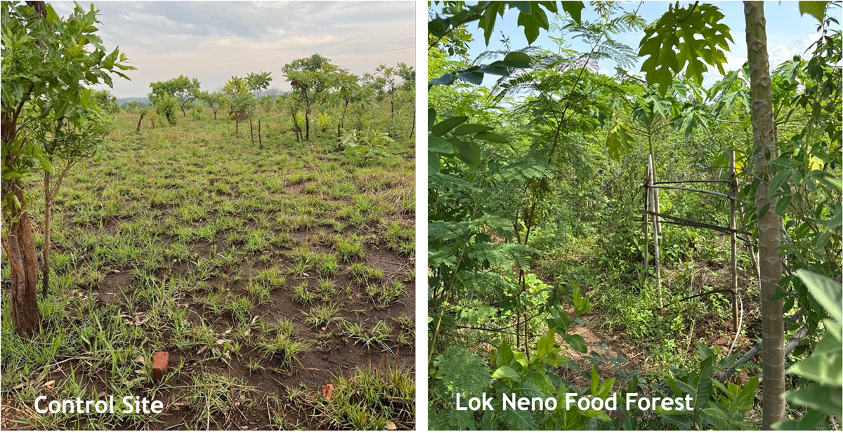
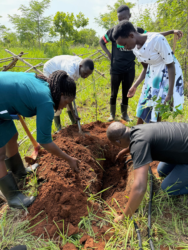
At African Women Rising's RD Demonstration, Training, and Research Site, we are developing approaches for understanding the impacts of RD on our key impact areas biodiversity, soil health, and hydrology. Since RD takes advantage of a manifold of ecosystem services, the observational strategy differs quite a bit from mapping fields farmed using conventional agriculture based on mono-cropping. The technology and science needs to be able to capture complex ecosystem functions in highly biodiverse environments.
To develop the scientific basis, we are comparing multiple parameters measured at Lok Neno to a control site outside the farm.
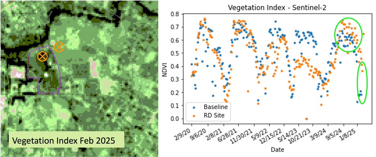
Remote sensing gives us a first glance of how we can map changes in the long term. The Normalized Difference Vegetation Index (NDVI) is one example of an indicator that can provide insights into the health of the system. At Lok Neno, we can already see clear signs of improvements in plant health and vegetation density just one year after implementation. Values are significantly higher inside the food forest than the control site and vegetation stays healthy even during the dry season.
As the spatial resolution of satellite data is limited, we are complementing the data with comprehensive local surveys and lab studies. Recently, soil moisture sensors and a weather station have been installed to capture changes on the ground as we are studying the stabilization of the local hydrology.
-
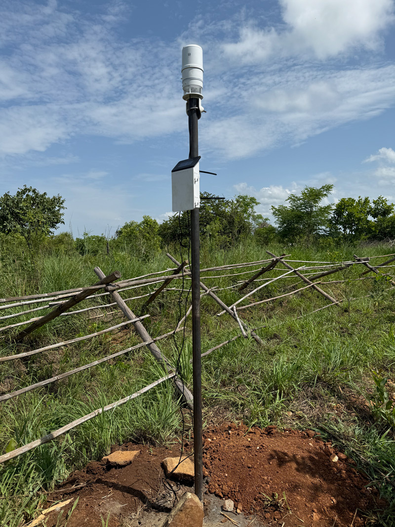 Weather station and data hub for soil moisture and water level observations. Source: Carmen Blackwood
 -
 Installation of soil moisture and soil water potential sensors. Source: Carmen Blackwood
In partnership with Gulu University, we are currently creating detailed laboratory studies that further enhance our understanding of improvements in the soil and linkages to plant health and nutrients - directly linking ecosystem to human health.
A Scalable, Science-Led Model for RegenerationA Scalable, Science-Led Model for Regeneration
As we are developing the scientific basis for RD, we are working closely with organizations such as the Danish Refugee Council and the UN’s International Office for Migration to provide observing standards and protocols that bring novel insights to their programming. Having the ability to keep track of ecological indicators ensures long-term successes for the farmers and enhances the ability to adapt to any challenges.
The science-backed methodology makes it possible to replicate and scale RD across degraded landscapes in Uganda and beyond. Data-driven site selection, ongoing remote monitoring, and community engagement ensure that each intervention is effective and adaptive.
By weaving science into every stage of planning, implementation, and monitoring, Resilience Design is not only transforming landscapes—it’s building hope, autonomy, and resilience in some of the world’s most vulnerable communities.